9441. Water Hydrant, City of Madison
2024. City of Madison. Inventory of fire hydrants owned and maintained by Madison Water Utility. Also contains known private hydrants. Private hydrants are not actively m...
9441. Water Hydrant, City of Madison
2024. City of Madison. Inventory of fire hydrants owned and maintained by Madison Water Utility. Also contains known private hydrants. Private hydrants are not actively m...
9442. Water lines, Racine County
2017. Racine County. This data set was prepared from older topographic mapping, and may not reflect current conditions. Site investigation may be necessary to determine...
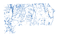
9443. Water Lines, Waupaca County
2020. Waupaca County. The hydrography coverage was created to represent rivers, water bodies and other hydrographic phenomena in Waupaca County. Hydrologic features were...
9444. Water Main Breaks, City of Madison
2017. City of Madison. Reported water main breaks - Madison Water Utility.
9445. Water Management Units, WI 2022
2022. Wisconsin Department of Natural Resources. This data represents water managment units locations for Wisconsin State in 2022. [Wisconsin's Water Management Units data layer contains 24 deline...
9446. Water Management Units, WI DNR
2024. Wisconsin Department of Natural Resources. Wisconsin's Water Management Units data layer contains 24 delineated basins created initially for the Priority Watershed Program. Bas...
9447. Water, Milwaukee County
2025. Milwaukee County. Data is refreshed Jan, Mar, May, Jul, Sep, Nov. To determine the last date edited, refer to the Date_Changed/GIS_Edit_Date fields for each individ...
9448. Water, Racine County
2017. Racine County. This data set was prepared from older topographic mapping, and may not reflect current conditions. Site investigation may be necessary to determine...
9449. Water Stream Line, Waukesha County
2024. Waukesha County. All planemetric water features from the Year 2000 orthophotography project. Feature service contains two features, Water Body Area displays polygo...
9450. Water Usage Data, City of Madison
2020. City of Madison. This data lists Madison Water Utility water usage in gallons by day from January 1, 2019 through August 23, 2020. This includes both total gallons...
9451. Water Utility Easement Lines, City of Madison
2017. City of Madison. The different classifications of water utility easement lines on the official map are as follows:Shape: describes the shape of each water utility e...
9452. Water Utility Easement Text, City of Madison
2017. City of Madison. The different classifications of the water utility easement text on the official map are as follows:Shape: describes the shape of each water utilit...
9453. Waterbodies, Vilas County
2025. Vilas County. Lakes, ponds and substantial rivers of Vilas County, Wisconsin. Digitized from 2013 LiDAR data and 2015 orthoimagery.
9454. Waterbody, Racine County
2017. Racine County. This data set was prepared from older topographic mapping, and may not reflect current conditions. Site investigation may be necessary to determine...
9455. Waterbody, Washington County
2024. Washington County. REQUIRED: A brief narrative summary of the data set.
9456. Waterline, Sauk County
2018. Sauk County. This feature class is made up of river and stream lines that represent flowlines and cartographic features such as stream centerlines and river ban...
9457. Waterlines, Vilas County
2025. Vilas County. River centerlines, streams, creeks, and waterbody shorelines for Vilas County, Wisconsin. Waterlines digitized from 2013 LiDAR data and 2015 orthoi...
9458. Watershed Plans, WI DNR
2015. Wisconsin Department of Natural Resources. This dataset represents areas that have watershed plans.
9459. Watersheds, Calumet County
2024. Calumet County. Calumet County watershed polygon data created by the Wisconsin Department of Natural Resources.
9460. Watersheds, Kewaunee County
2023. Kewaunee County. No description provided.