2023. Sheboygan County. Digital Elevation Model. This file is not hydro-enforced.
Search Results
1998. Wisconsin Department of Natural Resources. This Grid-format Digital Elevation Model (DEM) is a raster representation of land elevation of Wisconsin. This DEM ('demgw930') is derived from the...
3. Hydro-Enforced DEM, Sheboygan County
2023. Sheboygan County. Hydrologic-enforcement enables hydrologic models to simulate flow under bridges and through culverts by modifying the elevations of artificial im...
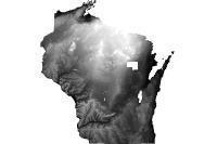
4. DEM (NED 10m) Wisconsin 2009
2009. Wisconsin Department of Natural Resources. This Elevation Grid is a raster representation of land elevation of Wisconsin, derived from the US Geological Survey's 10-meter National Elevation ...
5. Calumet County 2018 Raster DEM, Calumet County
2025. Calumet County. Calumet County 2018 Raster DEM file. This is a product of the 2018 LiDAR project. This file is approximately 8GB.
6. Digital Elevation Model (DEM) - 30 Meter, WI DNR
2019. Wisconsin Department of Natural Resources. This Grid-format Digital Elevation Model (DEM) is a raster representation of land elevation of Wisconsin. This DEM ("demgw930") is derived from the...
7. Wisconsin DEM and Hillshade from LiDAR - Index, WI DNR
2020. Wisconsin Department of Natural Resources. This service provides an Index intended for use with the WI DNR Image Services DEM from LiDAR (Units in Meters), DEM from LiDAR (Units in Feet), an...

8. Wisconsin DEM from LiDAR (Units in Feet), WI DNR
2019. Wisconsin Department of Natural Resources. Note: This service is only for using online; full resolution downloads are not supported. To enable pop ups when opening this in a new web map, th...
9. Wisconsin DEM from LiDAR (Units in Meters), WI DNR
2019. Wisconsin Department of Natural Resources. Note: This service is only for using online; full resolution downloads are not supported. To enable pop ups when opening this in a new web map, cli...
10. Calumet County 2018 Hydro Enforced DEM, Calumet County
2025. Calumet County. Calumet County 2018 hydro enforced DEM file. This is a product of the 2018 LiDAR project. This file is approximately 5.5GB.
11. Digital Elevation Model (DEM) - 10 Meter, WI DNR
2019. Wisconsin Department of Natural Resources. This Elevation Grid is a raster representation of land elevation of Wisconsin, derived from the US Geological Survey's 10-meter National Elevation ...
12. Wisconsin DEM and Hillshade from LiDAR - Web Map, WI DNR
2023. Wisconsin Department of Natural Resources. Web map displaying Wisconsin DNR-produced Digital Elevation Model (DEM) and Hillshade image services, along with their index layer, in formats that...
13. LiDAR-Derived Tiled Digital Elevation Model (DEM) for Jackson County, WI 2022
2022. U.S. Geological Survey. This data represents a LiDAR-derived tiled Digital Elevation Model (DEM) for Jackson County, Wisconsin in 2022. A DEM represents the bare-Earth sur...
14. LiDAR-Derived Countywide 30-cm Bare Earth DEM (m) for Jackson County, WI 2022
2022. Wisconsin Department of Administration - Geographic Information Office. This data represents a LiDAR-derived 30-cm Bare Earth Digital Elevation Model (DEM) for Jackson County, Wisconsin in 2022. This dataset has elevati...
15. LiDAR-Derived Countywide 1-ft Bare Earth DEM (ft) for Jackson County, WI 2022
2022. Wisconsin Department of Administration - Geographic Information Office. This data represents a LiDAR-derived 1-ft Bare Earth Digital Elevation Model (DEM) for Jackson County, Wisconsin in 2022. This dataset has elevatio...
16. LiDAR-Derived Countywide (redacted) 30-cm Bare Earth DEM (m) for Vilas County, WI 2022
2022. Wisconsin Department of Administration - Geographic Information Office. This data represents a LiDAR-derived 30-cm Bare Earth Digital Elevation Model (DEM) for Vilas County, Wisconsin (with tribal land redacted) in 2022...
17. LiDAR-Derived Countywide (redacted) 1-ft Bare Earth DEM (ft) for Vilas County, WI 2022
2022. Wisconsin Department of Administration - Geographic Information Office. This data represents a LiDAR-derived 1-ft Bare Earth Digital Elevation Model (DEM) for Vilas County, Wisconsin (with tribal land redacted) in 2022....

18. Wisconsin Hillshade from LiDAR, WI DNR
2019. Wisconsin Department of Natural Resources. Note: This service is only for using online; full resolution downloads are not supported. Hillshade image service created from Digital Elevation Mo...
2023. Sheboygan County. Digital Height Model. This dataset was created by subtracting the DEM from the DSM to create an estimated height of objects (trees, buildings, etc.).
20. Hillshade Image, Wisconsin 2001
2001. Wisconsin Department of Natural Resources. This TIF-format Hillshade image is a raster representation of land elevation of Wisconsin. This Hillshade ('hlximag30.tif') is derived from the 7.5...