1861. County Forests Taylor County, WI 2022
2022. Taylor County. This data layer represents county forests for Taylor County, Wisconsin in 2022.
1861. County Forests Taylor County, WI 2022
2022. Taylor County. This data layer represents county forests for Taylor County, Wisconsin in 2022.
1862. County Forests, Wisconsin 2015
2015. Wisconsin Department of Natural Resources. This is the County Forests layer dissolved by county from a stand (or forest management) layer used in the Wisconsin Forest Inventory & Reporting S...
1863. County Forests Wisconsin, 2016
2016. Wisconsin Department of Natural Resources. This is the County Forests layer dissolved by county from a stand (or forest management) layer used in the Wisconsin Forest Inventory and Reporting...
1864. County Forests Wood County, WI 2016
2016. Wood County. This polygon data layer represents county forests for Wood County, Wisconsin in 2016. It is a feature class within the geodatabase, Wood_CountyFore...
1865. County Forests Wood County, WI 2017
2017. Wood County. This data layer represents county forests for Wood County, Wisconsin at year-end 2017. It is a feature class within the geodatabase, 'Wood_CountyFo...
1866. County Forests Wood County, WI 2018
2018. Wood County. This data represents county forests for Wood County, Wisconsin in 2018. [This dataset shows the locations of the Wood County Forests.].
1867. County Highways, Kewaunee County
2024. Kewaunee County. No description provided.
1868. County Lands Washburn County, WI 2021
2021. Washburn County. This data represents county lands for Washburn County, Wisconsin in 2021.
1869. County Lands Washburn County, WI 2022
2022. Washburn County. This data represents county lands for Washburn County, Wisconsin in 2022.
1870. County Parcels, Jackson County
2025. Jackson County. A view layer used for sharing county owned land in the Jackson County Open Data Hub.
1871. County Park Boundaries, Waukesha County
2024. Waukesha County. Waukesha County Parks System Trails, Park Boundaries, and Management Areas.
1872. County Park Hiking Trails Designation, Waukesha County
2025. Waukesha County. Waukesha County Parks System Trails, Park Boundaries, and Management Areas.
1873. County Park Mountain Bike Trails, Waukesha County
2025. Waukesha County. Waukesha County Parks System Trails, Park Boundaries, and Management Areas.
1874. County Park Points, Waushara County
2020. Waushara County. No description provided.
1875. County Park Polygons, Waushara County
2020. Waushara County. No description provided.
1876. County Park Trails Overview, Waukesha County
2025. Waukesha County. Waukesha County Parks System Trails, Park Boundaries, and Management Areas.
1877. County Park Trails, Waukesha County
2024. Waukesha County. Waukesha County Parks System Trails, Park Boundaries, and Management Areas.
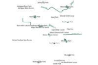
1878. County Park Trails, Waushara County
2020. Waushara County. A layer of County park trails.
1879. County Parks and Trails, Waukesha County
2024. Waukesha County. Waukesha County Parks System Trails, Park Boundaries, and Management Areas.
1880. County Parks La Crosse County, WI 2016
2016. La Crosse County. This layer represents county parks for LaCrosse County, Wisconsin in 2016.[La Crosse County Parks parcel mapping of La Crosse County, Wisconsin rep...