881. Village of North Bay 2035 Land Use Plan, Racine County
2020. Racine County. ****Converted to NAD83(2011) by ProWest & Associates Inc in January of 2019."The year 2035 regional land use plan incorporates the basic principles...
881. Village of North Bay 2035 Land Use Plan, Racine County
2020. Racine County. ****Converted to NAD83(2011) by ProWest & Associates Inc in January of 2019."The year 2035 regional land use plan incorporates the basic principles...
882. Village of Rochester 2035 Land Use Plan, Racine County
2020. Racine County. ****Converted to NAD83(2011) by ProWest & Associates Inc in January of 2019."The year 2035 regional land use plan incorporates the basic principles...
883. Village of Rochester 2035 Planned Urban Service Area, Racine County
2020. Racine County. ****Converted to NAD83(2011) by ProWest & Associates Inc in January of 2019."The year 2035 regional land use plan incorporates the basic principles...
884. Village of Sturtevant 2035 Land Use Plan, Racine County
2020. Racine County. ****Converted to NAD83(2011) by ProWest & Associates Inc in January of 2019."The year 2035 regional land use plan incorporates the basic principles...
885. Village of Union Grove 2035 Land Use Plan, Racine County
2020. Racine County. ****Converted to NAD83(2011) by ProWest & Associates Inc in January of 2019."The year 2035 regional land use plan incorporates the basic principles...
886. Village of Waterford 2035 Land Use Plan, Racine County
2020. Racine County. ****Converted to NAD83(2011) by ProWest & Associates Inc in January of 2019."The year 2035 regional land use plan incorporates the basic principles...
887. Village of Wind Point 2035 Land Use Plan, Racine County
2020. Racine County. ****Converted to NAD83(2011) by ProWest & Associates Inc in January of 2019."The year 2035 regional land use plan incorporates the basic principles...
888. Village of Yorkville 2035 Planned Urban Service Area, Racine County
2020. Racine County. ****Converted to NAD83(2011) by ProWest & Associates Inc in January of 2019."The year 2035 regional land use plan incorporates the basic principles...
889. Village of Yorkville 2035, Racine County
2020. Racine County. ****Converted to NAD83(2011) by ProWest & Associates Inc in January of 2019."The year 2035 regional land use plan incorporates the basic principles...
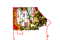
890. VillageofCaledonia 2035LandUsePlan, Racine County
2020. Racine County. ****Converted to NAD83(2011) by ProWest & Associates Inc in January of 2019."The year 2035 regional land use plan incorporates the basic principles...
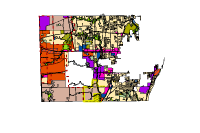
891. VillageofMtPleasant 2035LandUsePlan, Racine County
2020. Racine County. ****Converted to NAD83(2011) by ProWest & Associates Inc in January of 2019."The year 2035 regional land use plan incorporates the basic principles...
892. Bike Hazards City of Madison, WI 2024
2024. City of Madison - Metropolitan Planning Organization (MPO). This data represents bike hazards for the City of Madison, Wisconsin in 2024. [Bike HazardsJurisdiction (Jurisdiction) Maintaining organization. Pu...
893. Land Use Lincoln County, WI 2019
2019. Lincoln County. This data represents land use for Lincoln County, Wisconsin in 2019.[This publication level, polygon feature class provides a graphical representat...
894. Land Use Lincoln County, WI 2020
2020. Lincoln County. This data represents land use for Lincoln County, Wisconsin in 2020. [This publication level, polygon feature class provides a graphical representa...
895. Land Use Lincoln County, WI 2021
2021. Lincoln County. This data represents land use for Lincoln County, Wisconsin in 2021. [This publication level, polygon feature class provides a graphical representa...
896. Land Use Lincoln County, WI 2022
2022. Lincoln County. This data represents land use for Lincoln County, Wisconsin in 2022. [This publication level, polygon feature class provides a graphical representa...
897. Milwaukee County Culvert Points, Milwaukee County
2024. Milwaukee County. Countywide culvert points were produced by Ayres from 2020 Lidar data for MMSD and shared with MCLIO for public distribution. Points represent the ...
898. Addresses Taylor County, WI 2019
2019. Taylor County. This data layer represents addresses for Taylor County, Wisconsin in 2019.[This data set consists of digital map files containing addressing or sit...
899. Addresses Taylor County, WI 2020
2020. Taylor County. This data layer represents addresses for Taylor County, Wisconsin in 2020. [This data set consists of digital map files containing addressing or si...
900. Addresses Taylor County, WI 2021
2021. Taylor County. This data represents addresses for Taylor County, WIsconsin in 2021. [This data set consists of digital map files containing addressing or site acc...