1. 1) Racine County Mapbook, Racine County
2020. Racine County. This web map app can be used to find information about parcels in Racine County, Wisconsin, by searching for Parcel ID Number and Address. Find...
1. 1) Racine County Mapbook, Racine County
2020. Racine County. This web map app can be used to find information about parcels in Racine County, Wisconsin, by searching for Parcel ID Number and Address. Find...
2. 100 Year Floodplane Zoning District, Washington County
2023. Washington County. No description provided.
3. 100 Year Floodplane Zoning District, Washington County
2024. Washington County. No description provided.

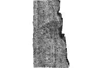
4. 1928 Aerial Photo, Milwaukee County
2022. Milwaukee County. greyscale non-ortho-rectified vertical aerial photography covering portions of Milwaukee County - believed to have been captured in 1928 - resoluti...
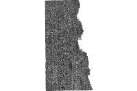
5. 1937 Aerial Photo, Milwaukee County
2022. Milwaukee County. Aerial Photographs (Contact Prints) of Milwaukee, 1937.Source: USDADate flown: WX 8: flown September 26, 1937 WX 9: flown July 26, 1937 W...
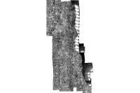
6. 1951 Aerial Photo, Milwaukee County
2022. Milwaukee County. greyscale non-ortho-rectified vertical aerial photography covering Milwaukee County Wisconsin; captured May 1951; resolution is 16 inches per pixel...
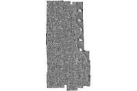
7. 1956 Aerial Photo, Milwaukee County
2022. Milwaukee County. greyscale non-ortho-rectified vertical aerial photography covering Milwaukee County Wisconsin; captured in 1956; approx. resolution 12 inches per p...
8. 1963 Aerial Photo, Milwaukee County
2022. Milwaukee County. greyscale non-ortho-rectified vertical aerial photography covering Milwaukee County Wisconsin; captured March 1963; approx. resolution 12 inches pe...
9. 1967 Aerial Photo, Milwaukee County
2022. Milwaukee County. greyscale non-ortho-rectified vertical aerial photography covering Milwaukee County Wisconsin; captured April 1967; resolution of approx. 11 inches...

10. 1970 Aerial Photo, Milwaukee County
2022. Milwaukee County. greyscale non-ortho-rectified vertical aerial photography covering Milwaukee County Wisconsin; captured May 1970; resolution of approx. 11 inches p...
11. 1975 Aerial Photo, Milwaukee County
2022. Milwaukee County. greyscale non-ortho-rectified vertical aerial photography covering Milwaukee County Wisconsin; captured May 1975; resolution of approx. 11 inches p...
12. 1976 Aerial Photo, Milwaukee County
2022. Milwaukee County. color non-ortho-rectified vertical aerial photography covering a portion of Milwaukee County Wisconsin; captured April 1976; resolution of approx. ...
13. 1980 Aerial Photo, Milwaukee County
2023. Milwaukee County. greyscale non-ortho-rectified vertical aerial photography covering Milwaukee County Wisconsin; captured April 1980; resolution of approx. 11 inches...
14. 1985 Aerial Photo, Milwaukee County
2022. Milwaukee County. greyscale non-ortho-rectified vertical aerial photography covering Milwaukee County Wisconsin; captured March-April 1985; resolution of approx. 11 ...
15. 1990 Aerial Photo, Milwaukee County
2022. Milwaukee County. greyscale non-ortho-rectified vertical aerial photography covering Milwaukee County Wisconsin - captured March 1990 - resolution of approx. 12 inch...
16. 1990-2000 Election Data with 2011 Wards, WI LTSB
2023. Wisconsin Legislative Technology Services Bureau. Election Data Attribute Field Definitions | Wisconsin Cities, Towns, & Villages Data AttributesWard Data Overview: These municipal wards were creat...
17. 1990-2000 Election Data (with 2011 Wards), Wisconsin 2011
2011. Wisconsin Legislative Technology Services Bureau. This data layer represents various election results for 1990-2000 in Wisconsin, mapped with 2011 ward boundaries. [Election Data Overview: Election...
18. 1990-2000 Election Data (with 2017 Wards) Wisconsin, 2017
2017. Wisconsin Legislative Technology Services Bureau. This data layer represents various election results for 1990-2000 in Wisconsin, mapped with 2017 ward boundaries. [Ward Data Overview: Fall 2017 mu...
19. 1990-2000 Election Data with 2020 Wards, WI LTSB
2023. Wisconsin Legislative Technology Services Bureau. Election Data Attribute Field Definitions | Wisconsin Cities, Towns, & Villages Data Attributes Ward Data Overview:July 2020 municipal wards were c...
20. 1990-2000 Election Data (with 2020 Wards) Wisconsin, 2020
2020. Wisconsin Legislative Technology Services Bureau. This data represents election results for 1990-2000 in Wisconsin, mapped with 2020 ward boundaries. [Ward Data Overview: July 2020 municipal wards ...