1. 100 Year Floodplane Zoning District, Washington County
2023. Washington County. No description provided.
1. 100 Year Floodplane Zoning District, Washington County
2023. Washington County. No description provided.
2. 100 Year Floodplane Zoning District, Washington County
2024. Washington County. No description provided.
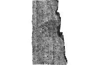
3. 1928 Aerial Photo, Milwaukee County
2022. Milwaukee County. greyscale non-ortho-rectified vertical aerial photography covering portions of Milwaukee County - believed to have been captured in 1928 - resoluti...
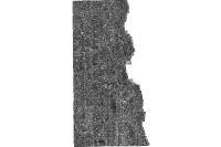
4. 1937 Aerial Photo, Milwaukee County
2022. Milwaukee County. Aerial Photographs (Contact Prints) of Milwaukee, 1937.Source: USDADate flown: WX 8: flown September 26, 1937 WX 9: flown July 26, 1937 W...
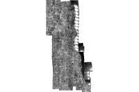
5. 1951 Aerial Photo, Milwaukee County
2022. Milwaukee County. greyscale non-ortho-rectified vertical aerial photography covering Milwaukee County Wisconsin; captured May 1951; resolution is 16 inches per pixel...
6. 1956 Aerial Photo, Milwaukee County
2022. Milwaukee County. greyscale non-ortho-rectified vertical aerial photography covering Milwaukee County Wisconsin; captured in 1956; approx. resolution 12 inches per p...
7. 1963 Aerial Photo, Milwaukee County
2022. Milwaukee County. greyscale non-ortho-rectified vertical aerial photography covering Milwaukee County Wisconsin; captured March 1963; approx. resolution 12 inches pe...
8. 1967 Aerial Photo, Milwaukee County
2022. Milwaukee County. greyscale non-ortho-rectified vertical aerial photography covering Milwaukee County Wisconsin; captured April 1967; resolution of approx. 11 inches...

9. 1970 Aerial Photo, Milwaukee County
2022. Milwaukee County. greyscale non-ortho-rectified vertical aerial photography covering Milwaukee County Wisconsin; captured May 1970; resolution of approx. 11 inches p...
10. 1975 Aerial Photo, Milwaukee County
2022. Milwaukee County. greyscale non-ortho-rectified vertical aerial photography covering Milwaukee County Wisconsin; captured May 1975; resolution of approx. 11 inches p...