1681. Right-of-Way Lines, Kenosha County
2022. Kenosha County. Kenosha County Right-of-Way lines. This data is updated daily.
1681. Right-of-Way Lines, Kenosha County
2022. Kenosha County. Kenosha County Right-of-Way lines. This data is updated daily.
1682. Right-of-Way Polygons, Kenosha County
2022. Kenosha County. Kenosha County Right-of-Way polygons. This data is updated daily.
1683. Water lines, Racine County
2017. Racine County. This data set was prepared from older topographic mapping, and may not reflect current conditions. Site investigation may be necessary to determine...
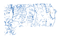
1684. Water, Racine County
2017. Racine County. This data set was prepared from older topographic mapping, and may not reflect current conditions. Site investigation may be necessary to determine...
1685. Waterbody, Racine County
2017. Racine County. This data set was prepared from older topographic mapping, and may not reflect current conditions. Site investigation may be necessary to determine...
1686. Racine County Parcels - GCS WGS 1984, Racine County
2024. Racine County. ***The data is updated nightly with current ownership and geometry changes.This data set consists of digital map files containing parcel-level cada...
1687. Subdivisions, Kenosha County
2022. Kenosha County. Kenosha County Subdivisions. This data is updated on a daily basis, as changes occur.
1688. Milwaukee County Culvert Points, Milwaukee County
2024. Milwaukee County. Countywide culvert points were produced by Ayres from 2020 Lidar data for MMSD and shared with MCLIO for public distribution. Points represent the ...
1689. Condominiums, Kenosha County
2022. Kenosha County. Kenosha County Condominiums. This data is updated on a daily basis, as changes occur.
1690. Pavement Edges, Kenosha County
2022. Kenosha County. Kenosha County Pavement Edges. This data is updated intermittently on an as-needed basis.
1691. Ortho 2022 - 3inch - 4band - Sheboygan Area, Sheboygan County
2024. Sheboygan County. 3-inch, 4-band SID files (Gen4) of only City of Sheboygan, City of Sheboygan Falls, and Village of Kohler.Imagery is in County's custom projection....
1692. Municipal Boundaries, Kenosha County
2022. Kenosha County. Kenosha County Municipal Boundaries. This data is updated on an as-needed basis, as changes occur.
1693. Parks POI Amenities VIEW *PUBLIC*, Kenosha County
2024. Kenosha County. Kenosha County Parks Amenities and Points of Interest. This data is updated as changes occur.
1694. LiDAR Viewer, Kewaunee County
2024. Kewaunee County. Online application for viewing lidar and aerial imagery data for Kewaunee County, hosted by Ayres Associates.
1695. Milwaukee County Parcels with Property Information, Milwaukee County
2025. Milwaukee County. Polygons representing tax parcels covering Milwaukee County, Wisconsin. There is one polygon per parcel identifier (TAXKEY) and 'stacked' polygons...
1696. Milwaukee County Census Block Groups, Milwaukee County
2024. Milwaukee County. 2020 Census block group polygons covering Milwaukee County, WI for use with block group-level American Community Survey data and 2020 Census data.O...
1697. Ortho 2022 - 3inch - 4band - Municipality, Sheboygan County
2024. Sheboygan County. 3-inch, 4-band SID files (Gen3) of County Municipalities EXCEPT City of Sheboygan, City of Sheboygan Falls, and Village of Kohler (provided in sepa...
1698. PLSS Sections, Racine County
2025. Racine County. ****Converted to NAD83(2011) by ProWest & Associates Inc in January of 2019.This data is the first division of the PLSS, Sections.
1699. Zoning - Shoreland Areas, Kenosha County
2022. Kenosha County. Kenosha County Shoreland Zoning Areas.This data is updated on an as-needed basis, as zoning changes are made.
1700. Zoning Overlay Districts, Kenosha County
2022. Kenosha County. Kenosha County Zoning Overlay Districts. This data is updated on an as-needed basis, as zoning changes are made.