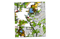
8281. Town of Waterford Planned Urban Service Area, Racine County
2020. Racine County. ****Converted to NAD83(2011) by ProWest & Associates Inc in January of 2019."The year 2035 regional land use plan incorporates the basic principles...
8281. Town of Waterford Planned Urban Service Area, Racine County
2020. Racine County. ****Converted to NAD83(2011) by ProWest & Associates Inc in January of 2019."The year 2035 regional land use plan incorporates the basic principles...
8282. Town of West Kewaunee Road Map, Kewaunee County
2023. Kewaunee County. No description provided.
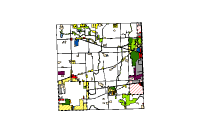
8283. Town of West Kewaunee Voting Ward Map, Kewaunee County
2024. Kewaunee County. No description provided.
8284. Town of Yorkville 2035 Land Use Plan, Racine County
2020. Racine County. ****Converted to NAD83(2011) by ProWest & Associates Inc in January of 2019."The year 2035 regional land use plan incorporates the basic principles...
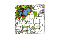
8285. Town of Yorkville 2035 Planned Urban Service Area, Racine County
2020. Racine County. ****Converted to NAD83(2011) by ProWest & Associates Inc in January of 2019."The year 2035 regional land use plan incorporates the basic principles...
8286. Town Orders, Sheboygan County
2025. Sheboygan County. Town orders show where roads and highways planned to be located when first established.
8287. Town Zoning, Waukesha County
2024. Waukesha County. Town Zoning.
8288. TownofBurlington 2035LandusePlan, Racine County
2017. Racine County. "The year 2035 regional land use plan incorporates the basic principles and concepts of the previously adopted plans. The plan promotes a compact, ...
8289. TownofDover 2035LandusePlan, Racine County
2020. Racine County. "The year 2035 regional land use plan incorporates the basic principles and concepts of the previously adopted plans. The plan promotes a compact, ...
8290. TownofNorway 2035LandUsePlan, Racine County
2020. Racine County. ****Converted to NAD83(2011) by ProWest & Associates Inc in January of 2019."The year 2035 regional land use plan incorporates the basic principles...
8291. TownofRaymond 2035LandusePlan, Racine County
2017. Racine County. "The year 2035 regional land use plan incorporates the basic principles and concepts of the previously adopted plans. The plan promotes a compact, ...
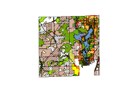
8292. TownofWaterford 2035LandUsePlan, Racine County
2020. Racine County. ****Converted to NAD83(2011) by ProWest & Associates Inc in January of 2019."The year 2035 regional land use plan incorporates the basic principles...
8293. TownofYorkville 2035LandUsePlan, Racine County
2020. Racine County. ****Converted to NAD83(2011) by ProWest & Associates Inc in January of 2019."The year 2035 regional land use plan incorporates the basic principles...
8294. Township , Kenosha County
2022. Kenosha County. Kenosha County Public Land Survey System (PLSS) Layers.
8295. Township, Eau Claire County
2022. Eau Claire County. A group of Public Land Survey System layers used as the cadastral reference system within Eau Claire county, Wisconsin. .
8296. Townships, Pierce County
2024. Pierce County. No description provided.
8297. TownZoningJurisdiction OpenData, Outagamie County
2025. Outagamie County. Town zoning jurisdiction polygon layer.
8298. Tract, WI DNR
2024. Wisconsin Department of Natural Resources. Layer referencing Esri's feature layer, Health Insurance Coverage Variables - Tracts from ACS 2015-2019, with its default extent centered on Wiscon...
8299. Traffic Counts, WI DOT
2024. Wisconsin Department of Transportation. The Wisconsin Traffic Counts dataset combines traffic count data with GIS mapping technology to display data in a tabular format, on a map, or both...
8300. Traffic Engineering Signs, City of Madison
2022. City of Madison. Fields ObjectID: GIS auto-generated unique identifier Angle: Sign rotation Text: Traffic Engineering department shorthand for sign type Text...